
The course
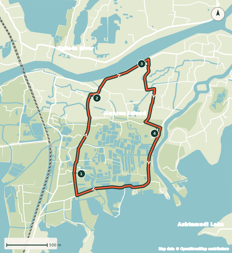
One 5 km loop on Munroe Island, run again and again. Mostly paved village roads and canal bunds, almost flat, lit by your headlamp after dark.
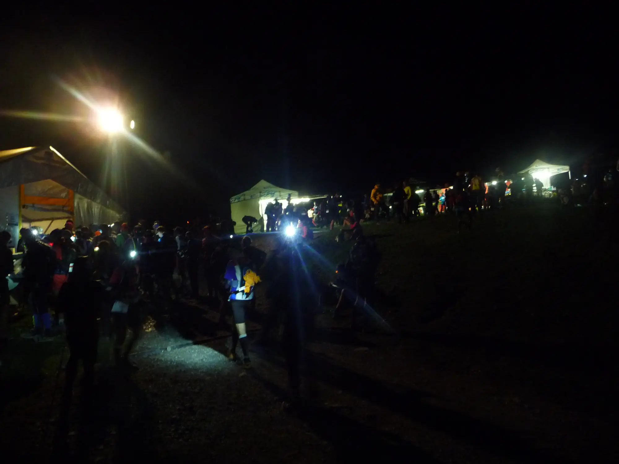
Runners with headlamps at night, UTMB 2021. Photo: Anthospace, CC BY-SA 4.0
- Loop
- 5 km, clockwise
- Height above sea level
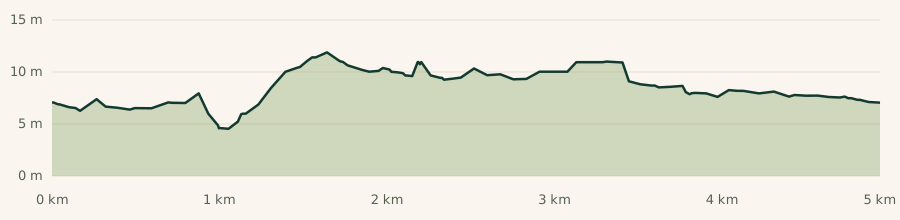
- 4 to 12 m
- Climbing per lap
- About 16 m
- Surface
- Mostly paved
- Aid
- Race village and a midway water point
- Lighting
- Partly lit, headlamp required
Route option A: the village loop
The loop runs clockwise through the village roads of Munroe Island, between the Kallada River, the canals and fish ponds, and the edge of Ashtamudi Lake. We are finalising it with the panchayat and residents, so details may still change. The race village, where every lap starts and finishes, will be confirmed soon.
As mapped, route option A measures 4.95 km. The race loop will be measured to exactly 5 km before race day.
Why one loop works here
One loop keeps runners, medical support and the event together in one place.
A compact course
One short loop, repeated, on roads the island knows well.
A central race village
Food, medical support, timing and your crew are all in one place, and you pass it every lap.
Easy to watch
Families see their runners every hour without having to travel along the course.
Surface and terrain
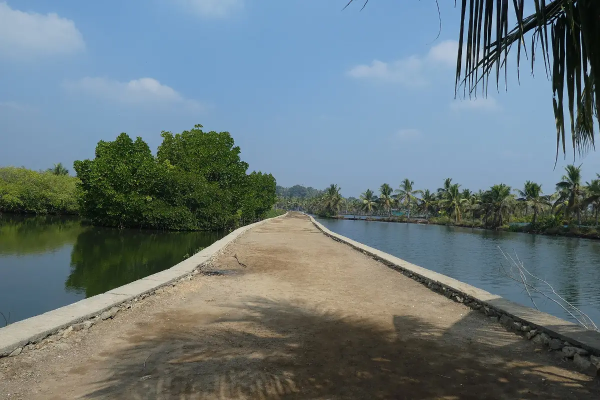
Most of the loop is narrow paved village road. Short sections follow the bunds along the canals, which are packed earth and can be uneven. Road shoes are the right choice.
The island sits only just above the water, so there are no real climbs. Expect a few small bridges over canals and some tight turns.
Some roads are only a few metres wide. When faster runners come through, keep left and let them pass on the right.
Every kilometre is marked, and the turns are marked with reflective signs for the night laps.
Conditions
February on the Kerala coast is warm and humid. Expect around 30 to 32 °C at the 3 pm start, easing to the mid 20s °C overnight, with high humidity throughout.
The 50K starts in the heat of the afternoon. Start slower than you think you need to, and drink at the race village every lap.
Sunset is around 6:30 pm. After that, parts of the loop are lit only by houses and your own headlamp. Mosquitoes come out near the water after dusk.
Running on the island
Munroe Island is home to about 9,000 people, and the race runs past their front doors until 1 am. We are guests here.
- Keep noise down after 10 pm, on course and at the race village.
- Carry your own cup. Drop nothing on the island.
- Some roads stay open to residents. Follow the marshals.
- Buy from island shops and stay in island homestays where you can.